Our last few hours on the West Coast started by heading north from Hokitika towards Kumara Junction where we turned eastward. At Kumara we stopped to have a look at a photo gallery. The work was very good and I bought a print, I’ll have to have a look at it later to get the photographers name as I can’t find it on the Internet right now (found, it was Carey Dillon and the print purchased is called “Totara, Te Kinga, Lake Brunner“).
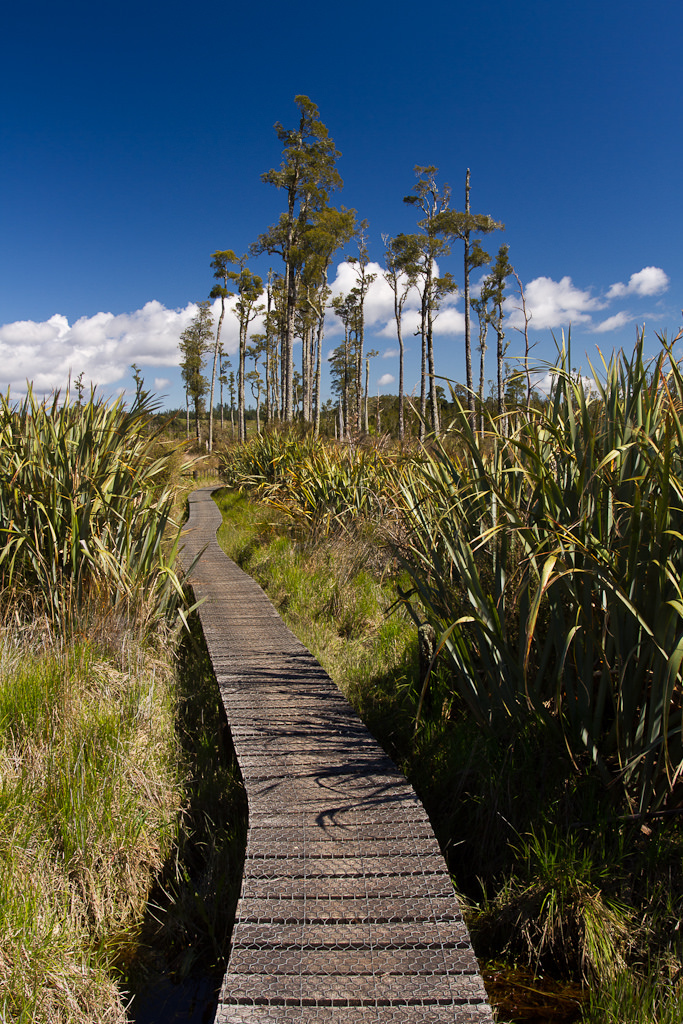
From Kumara we took a diversion from SH73 towards Lake Brunner where we had a couple of walks planned. We had been warned at the gallery that the first walk we were doing, the Bain Bay walk, might be truncated and this turned out to be the case. Recent bad weather in the previous weeks had washed away some of the track or boardwalk. It was hard to tell where the track was meant to go, it just ended at a lagoon. Before reaching the premature end we had walked over boardwalk and lakeside track amongst tall Kahikatea and large flax in the bright sunlight. It was another beautiful day and we could see clear across to the lake to distant townships. The print I had bought showed silhouetted trees against morning mist, we’d have to come back on a colder day much earlier to get a similar sight.
 Photo by Brendon & Keryn
 Photo by Brendon & Keryn
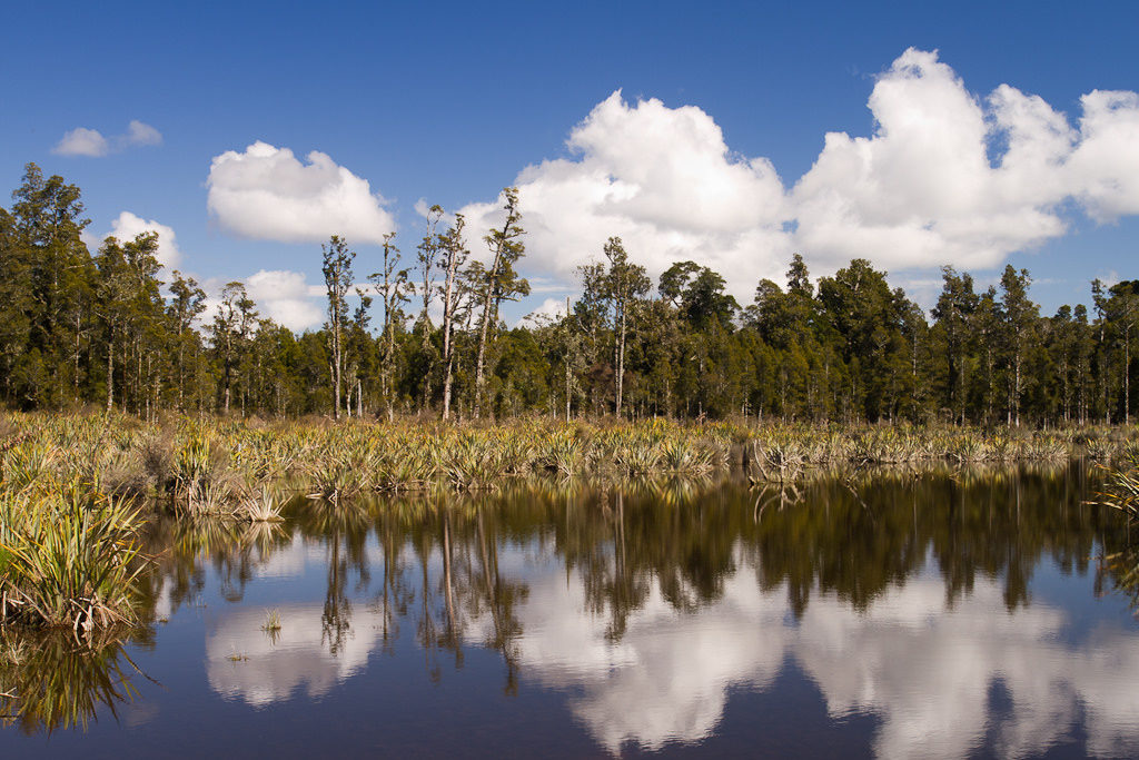 Photo by Brendon & Keryn
Our next little adventure was just down the road, the start of the Carew Falls Walk. We had a weka welcome us as we got ready and were soon hiking the gently rising track. It was only a quarter hour or so to the Carew Falls and while I took photos others relaxed and had more of the West Coast slice. The waterfall was fairly impressive and did its best to defy the unphotogenic nature it had been given at our gallery visit earlier.
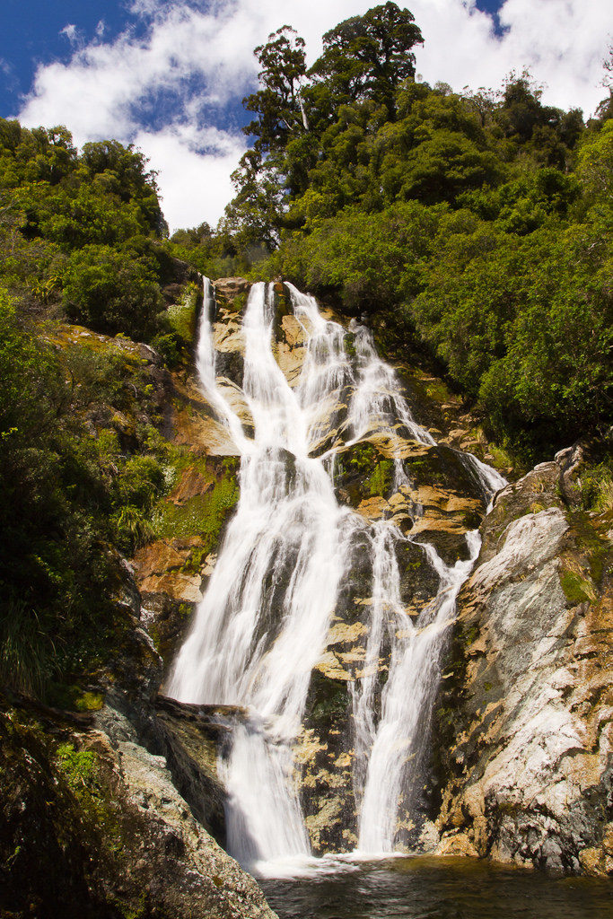 Photo by Brendon & Keryn
Getting quite hot in the sun while sitting on rocks we didn’t hang around for too long and heading back on the track, arriving at the car fairly quickly. It was now nearing lunchtime so we get off on the road looking for a nice spot to have lunch. This we found at a little bay on the lake side and we sat on the stone beach eating lunch, keeping an eye out for a couple of curious weka and enjoying the continued good weather. Being a stone beach with flat water I tried my hand at skimming a few likely looking stones. I started well and then quickly faded away, I should have quit while I was ahead.
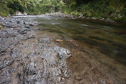
Not far down the road we stopped again near the point a stream left the southern end of the lake and I took a few more photos. Again some nice morning light with mist would have been wonderful, the afternoon shots not so great.
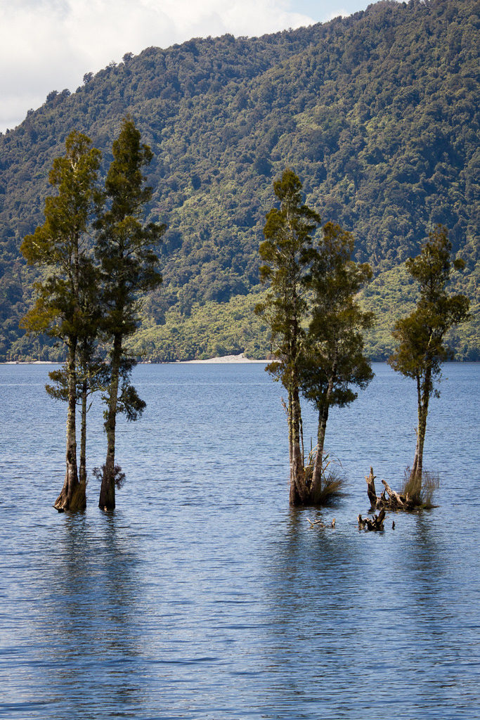 Photo by Brendon & Keryn
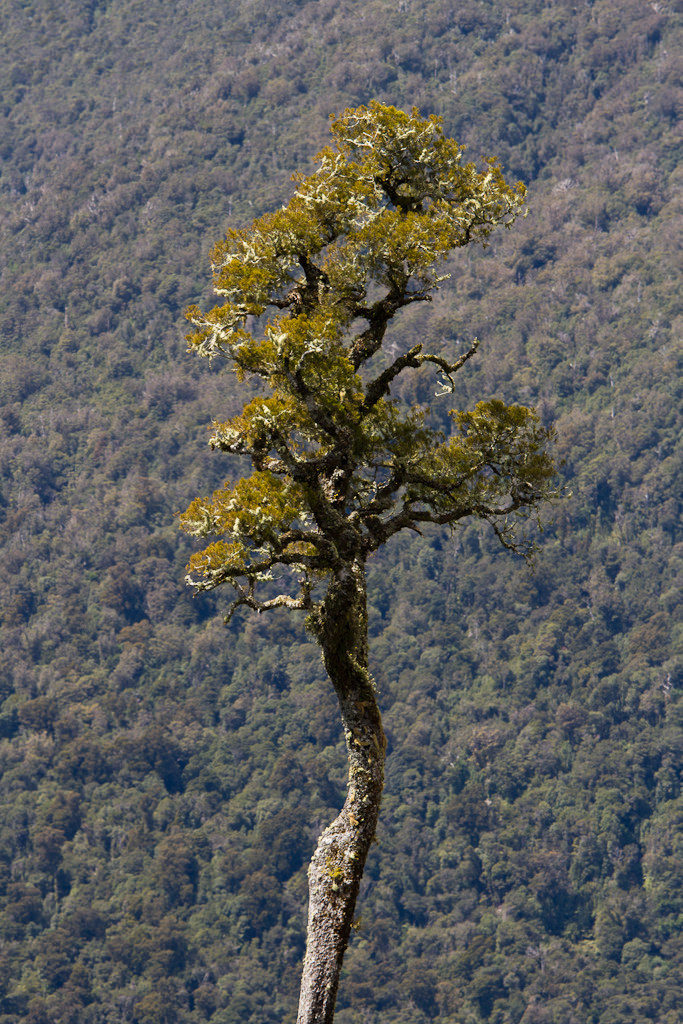 Photo by Brendon & Keryn
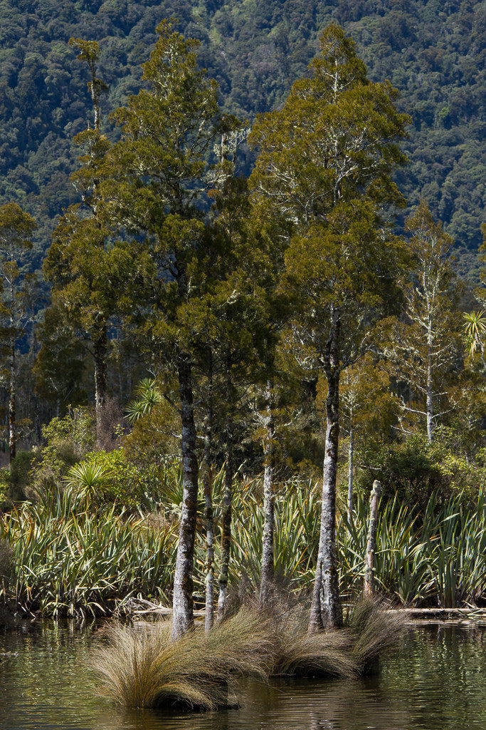 Photo by Brendon & Keryn
The road left the lake and we were soon back on SH73 following a wide braided river through valleys with snow covered peaks surrounding us. We had a few more stops, checking out a bridge leading to Deception Valley and the river flowing below.
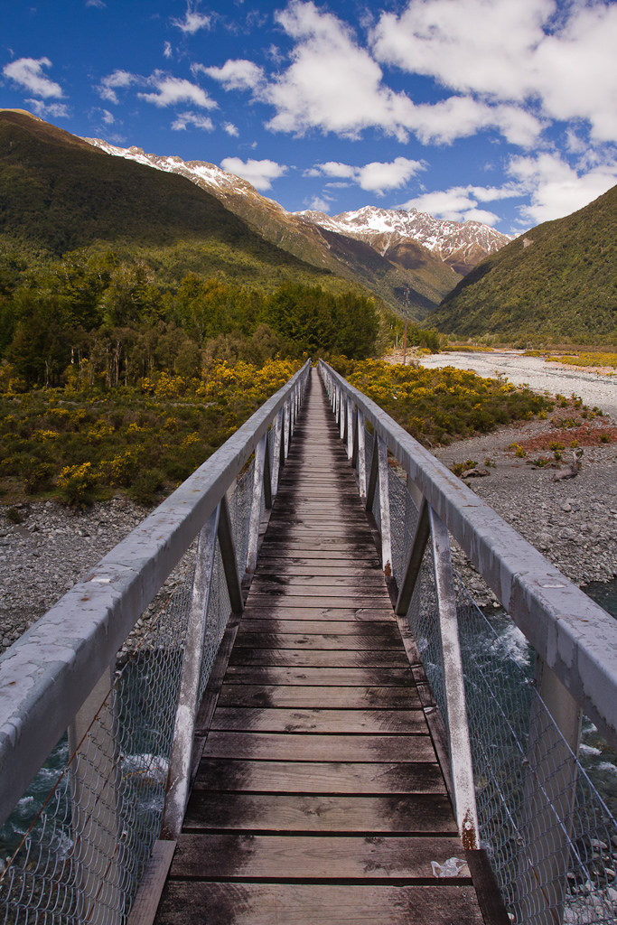 Photo by Brendon & Keryn
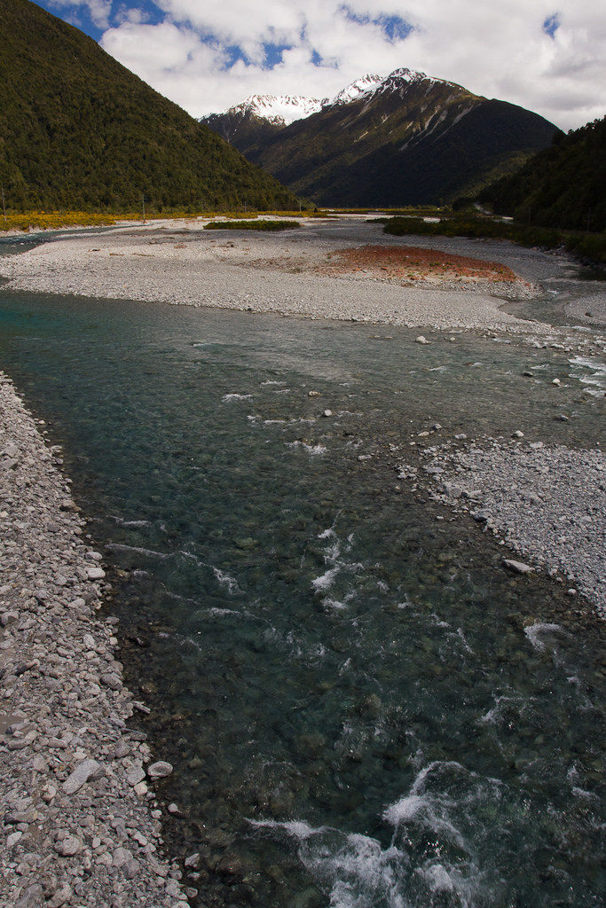 Photo by Brendon & Keryn
As the road climbed towards the Arthur’s Pass township there was the possibility of seeing some unique New Zealand wildlife and sure enough just around the bend from Reid Falls we interrupted four kea feeding on scraps on the road. Someone had either thrown out or accidentally dropped a polystyrene container of fast food and the kea were munching away, grudgingly flying off whenever a car came by. Not much further along the road we passed over a bridge through the valley and then stopped at a lookout above the bridge where there was another kea happily checking out all the vehicles as they came by. The kea seemed happiest with a campervan piloted by a single man why had a blow-up companion in the passenger seat, and another visible through the campervans side door. Taking his friends for a holiday?
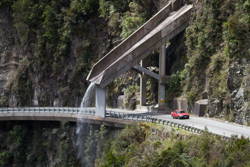 Photo by Brendon & Keryn
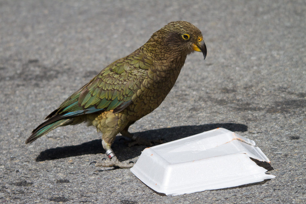 Photo by Brendon & Keryn
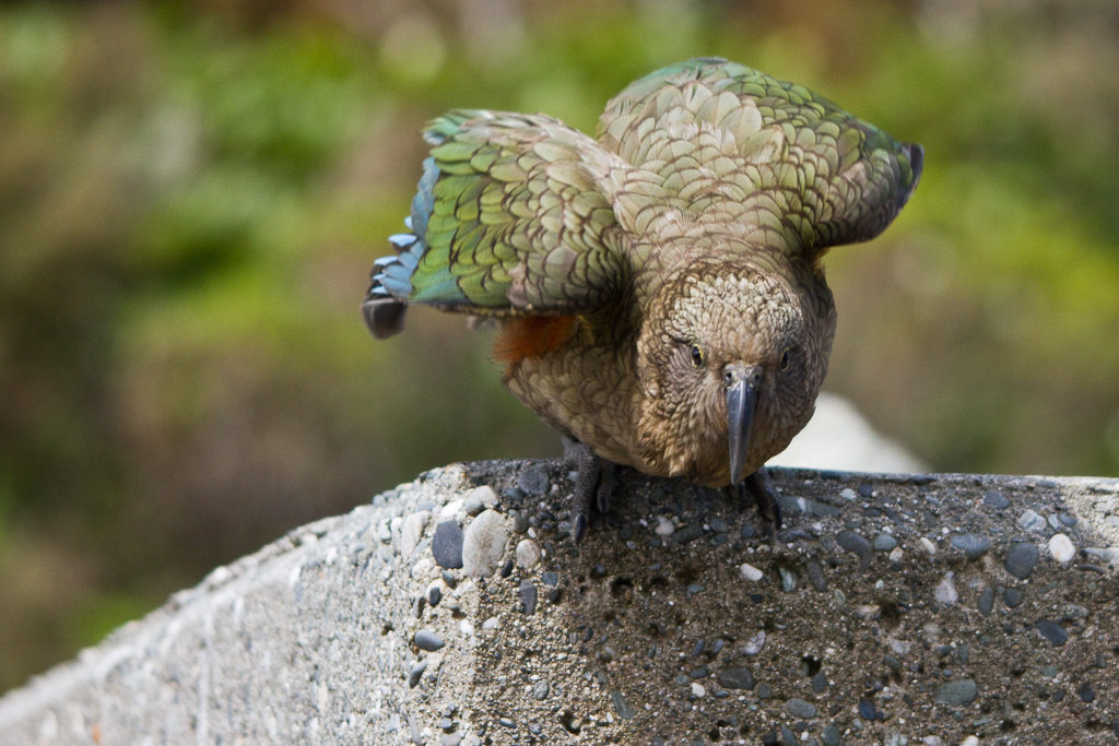 Photo by Brendon & Keryn
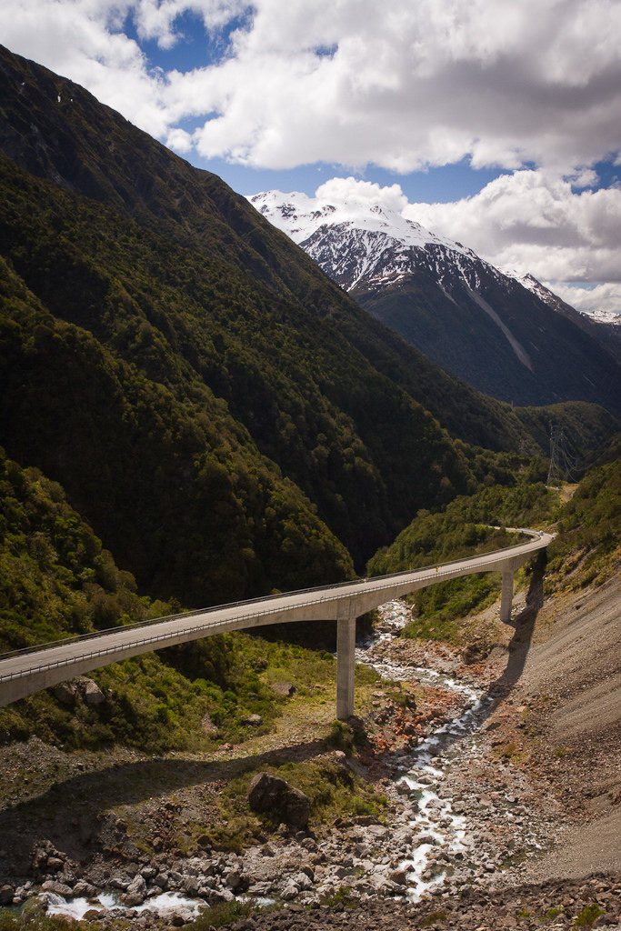 Photo by Brendon & Keryn
From here it wasn’t long to Arthur’s Pass and our accommodation at Arthur’s Hotel & Chalets which were actually rooms attached to a pub. It was obviously a quiet time of year as there didn’t seem to be many people staying and the complimentary jug of milk we received joined another jug of very past due date milk already in the small fridge – this was quickly returned to the staff. I don’t think we would have lasted more than a couple of days in our self catering family room, the beds were uncomfortable and it all looked a little dated. The cooking facilities were minimal, matched by the minimal cutlery. One of the drawers next to the fridge was falling off. Many people on trip advisor don’t have much good to say either (though others had a good stay). We cooked our own dinner and had desert in the restaurant area of the bar and while the service wasn’t great the food desert was good (though some of the menu options weren’t available because the regular chef wasn’t there that night which was a little strange).
Anyway, we weren’t staying to spend time in the accommodation. Before dinner we took a walk from the Chalets to the nearby Devil’s Punchbowl waterfall, accessed from a carpark a few hundred meters from the pub. There were kea in the carpark happy to pose for a few photos before we crossed the river and started uphill to the falls.
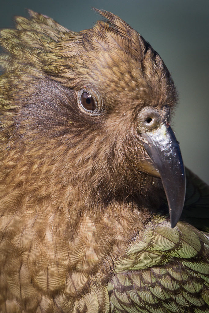 Photo by Brendon & Keryn
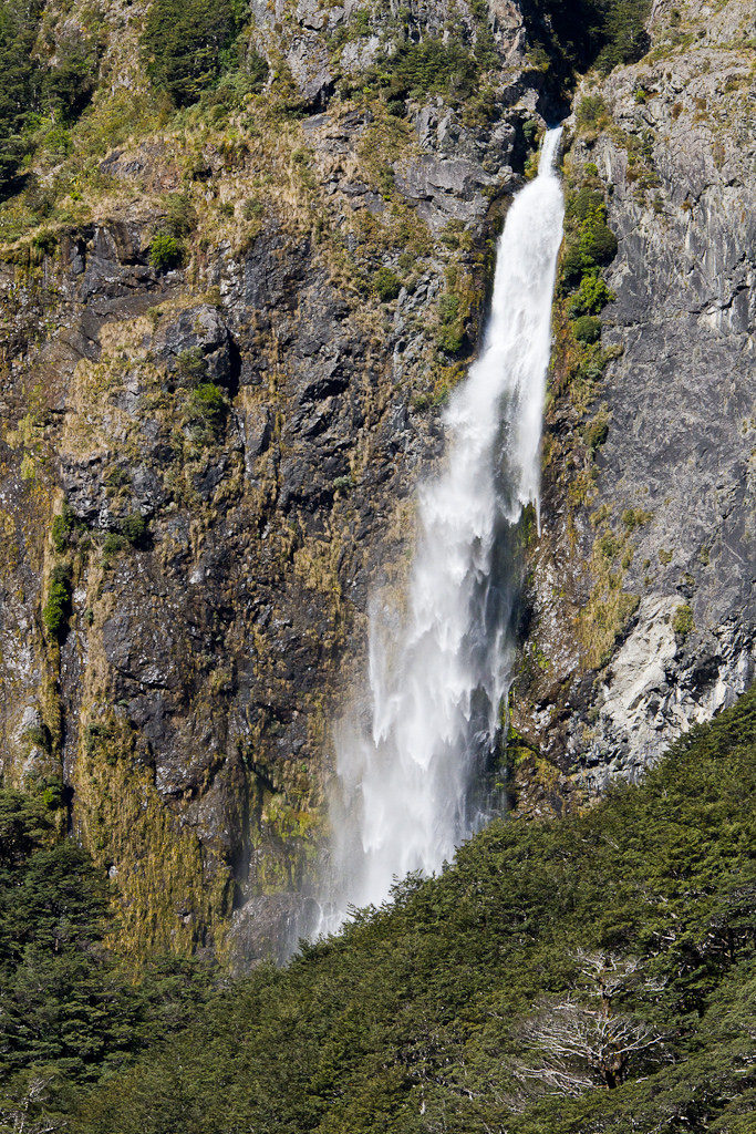 Photo by Brendon & Keryn
The track was quite steep with plenty of stairs, thankfully it wasn’t that long. At the end there was a wooden viewing platform with good views of the main fall of water and also the stream dropping away down the valley.
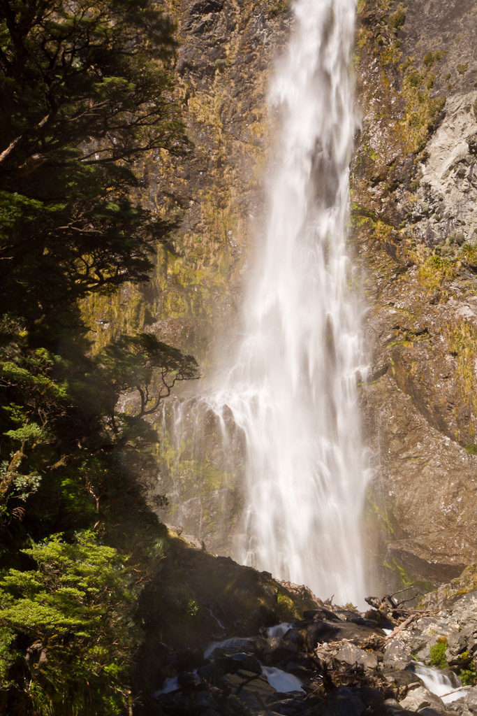 Photo by Brendon & Keryn
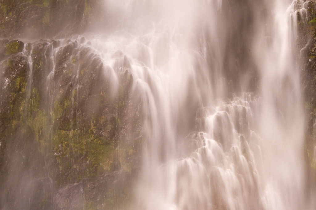 Photo by Brendon & Keryn
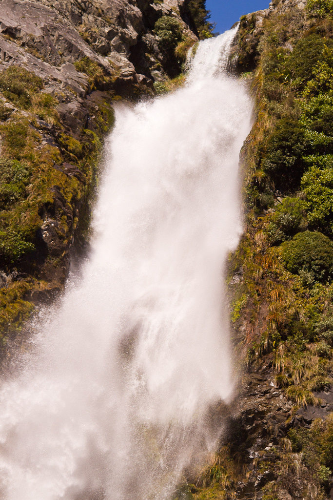 Photo by Brendon & Keryn
It was almost busy at the viewing platform with more people coming an d going than we’d seen on a track in a while. Once I’d taken plenty of photos we started back and I hung at the back to keep an eye out for bird-life and any other photo opportunities. There were excellent views to snow covered peaks and there were some interesting atmospheric effects occurring with lines of clouds in the sky. I had heard the high pitched peeping of birds on several occasions and finally looked in the right place at the right time and spotted a rifleman looking for food on a tree, staying still long enough for me to fire off a few photos.
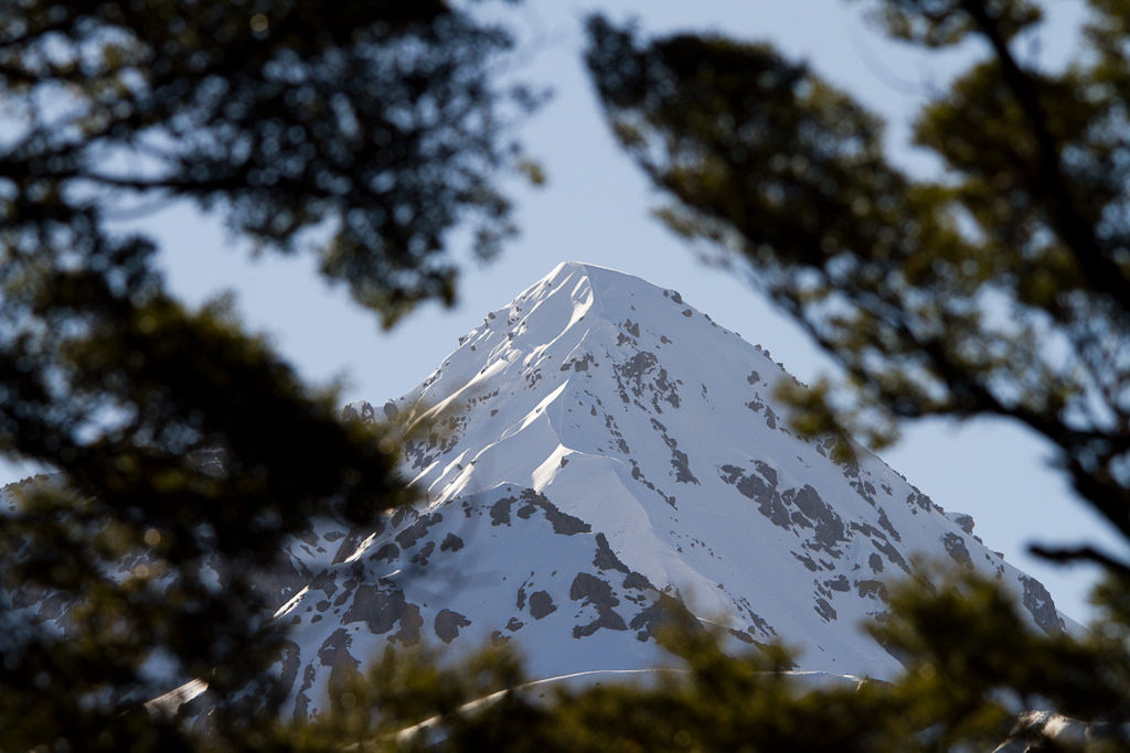 Photo by Brendon & Keryn
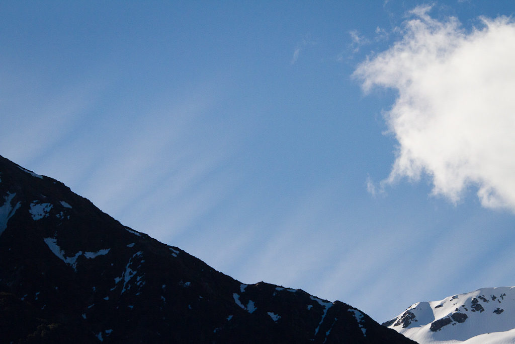 Photo by Brendon & Keryn
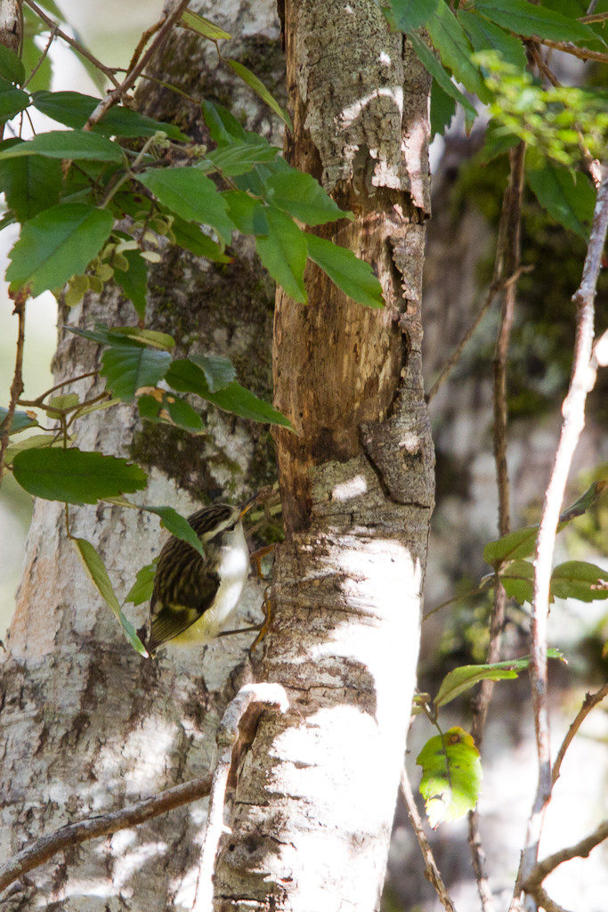 Photo by Brendon & Keryn
Back river side looking back at the falls the afternoon sun was creating rainbow colours in the falling spray so more photographs were taken, the last of the day.
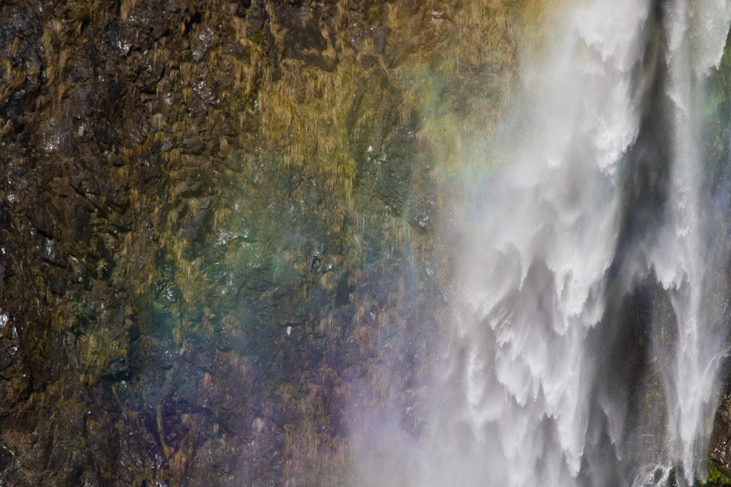 Photo by Brendon & Keryn
‘the road through the valley’?! that’s a bit of an understatement don’t you think! Beca – and the University of Canterbury structural engineering lecturers – are still waxing lyrical about the Otira Viaduct about a decade after it was opened!
Well, it may be related to me not bothering to find out what the road was called. Maybe that’s why I did IT at University?
Hi Brendon, the photographer and woodworker at Kumara is Carey Dillon and his website is http://www.careydillon.com
Thanks! I’ll update the post.